The laboratory of seismology of the University of Genoa, pertaining to the Earth, Environment and Life Sciences Department (DISTAV), was established in 1967 and, over the years, has developed "state of the art" methodologies and techniques in order to improve the knowledge in the seismological field.
The laboratory of seismology performs the collection, computerization of seismic and parametric data and the management of waveforms databases. It is also equipped with a seismic velocimetric and accelerometric temporary network for the rapid monitoring of seismic sequences in areas subject to strong earthquakes, explosions and induced vibrations. Over the years, it has increased its infrastructure by installing on the territory an increasing number of detection and acquisition equipments and it has refined analysis techniques for the automatic treatment of signals in real time that have allowed to obtain more and more accurate and reliable automatic monitoring procedures.
The laboratory of seismology is structured as follows:
● SISMONET
- Regional Seismic Network of Northwestern Italy (RSNI). The permanent real-time seismic network has been planned and developed over the years in order to ensure optimal monitoring of seismic activity in Piedmont, Liguria, northern Tuscany, Valle d'Aosta and, in general, cross-border areas between Italy, France and Switzerland. Since 1982, the RSNI network has evolved and improved its monitoring potential both through an increase in the number of stations and through the constant updating of the instrumentation used (seismic sensors, acquisition devices, transmission systems, power supply and protection equipment). Each installation site has been carefully selected in order to optimize the network geometry and guarantee a minimum level of anthropogenic-environmental noise, favouring installations on rock, free from significant local seismic amplification effects. Based on the technical specifications of the stations currently installed, it is possible to guarantee the precise and accurate location of seismic events even with local magnitude below 1.0, within the monitored regions. Moreover, the characteristics of the seismic stations of the RSNI network allow to have recordings of local, regional and teleseismic events with a quality standard fully compliant with that provided by the main national and international monitoring networks, with which the RSNI network cooperates and is also closely interconnected in real time.
For more information see the "seismic network" link in the menu.
- Mobile seismic network. The laboratory of seismology also features velocimetric and accelerometric seismic stations for the installation of temporary seismic networks independent or linkable in real time with the permanent RSNI network. These networks are generally planned and installed for three main types of interventions: • in case of a significant seismic event, in order to acquire information on the distribution of aftershocks and seismogenic structures; • for monitoring natural phenomena (induced seismicity or generated by active faults) or artificial phenomena (explosions, vibrations); • evaluation of amplification effects on areas of public interest for seismic microzonation purposes.
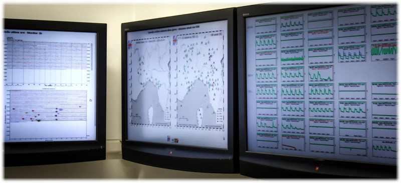
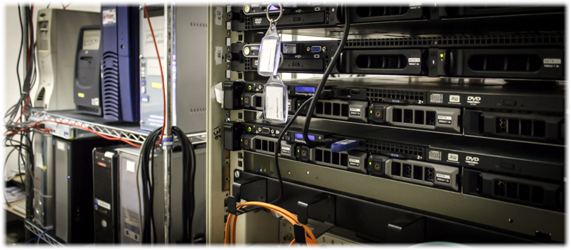
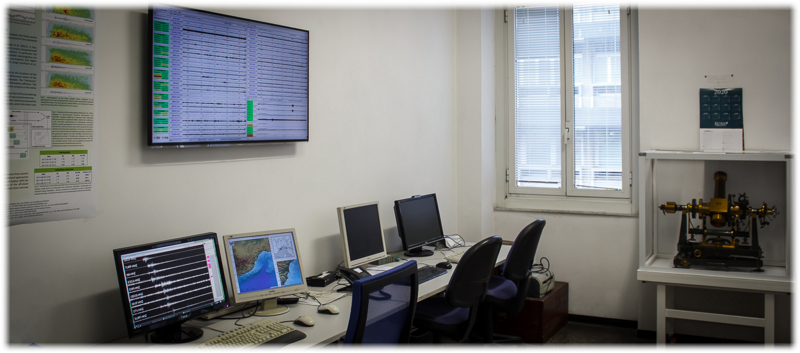
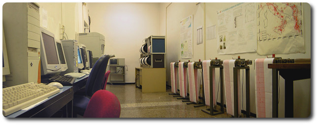
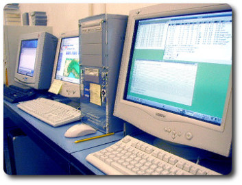
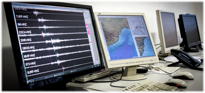
● (DPC) DATA PROCESSING CENTRE
The Data Processing Center located at the Laboratory of Seismology consists of a network of servers and workstations dedicated to the collection, analysis and cataloguing of data collected by the network. Moreover, at the center there is a database of waveforms recorded by the entire network. The DPC is connected with the main centers at European and worldwide level for the continuous exchange of information both in real time and deferred.
Automatic procedures are constantly active for the precise and reliable detection and localization of seismic events in the North-Western Italy area. Thanks to these procedures, developed within the Laboratory of Seismology, within 5 minutes after the occurrence of an earthquake, information about the event, such as location, magnitude, strong-motion parameters (PGA, PGV, PGD, Housner intensity, spectral amplitudes) and shaking maps are obtained and disseminated on the web. Finally, a careful manual review of all acquired seismic data is performed daily by the staff of the laboratory.
● SISMORISK
- Seismic Hazard Analyses : • compilation of seismic catalogues; • seismic analysis and characterization of seismogenic sources; • seismic hazard analysis using advanced probabilistic methods; • analysis of the epistemic uncertainty within models and input parameters; • elaboration of seismic hazard maps; • deaggregation of seismic hazard for the definition of seismic scenarios; • definition of seismic input for dynamic local seismic response analysis.
- Microzonation studies. Analysis of local amplification effects and preparation of microzonation maps based on different types of surveys: • 1st level qualitative analysis - geological, morphological and seismic classification of urban areas and recognition of areas susceptible to local amplification effects or coseismic effects; • 2nd and 3rd level qualitative analysis - study of local seismic response through experimental methods (based on the elaboration of seismic signals or environmental noise) and numerical simulation methods (based on the definition of underground stratigraphic models) - detailed (experimental and numerical) analysis of unstable slope areas; • validation, revision and interpretation of geotechnical and geophysical surveys (geognostic surveys, downhole, seismic profiles).
● SISMOAPP (Applied Seismology)
- Multi Channel Seismic. Application of passive seismic methods (dispersion curves from REMI or 2D arrays) and active seismic methods (dispersion curves from MASW and refracted wave tomography for the definition of the seismic wave velocity model and the subsequent classification of the site on the basis of the soil categories proposed by the Technical Standards for Construction.
- Available instrumetation for active and passive seismic surveys : • n°2 Geode Geometrics (24 + 24 channels); • n°48 geophones Oyo Geospace SNG 11D/PC-21 4.5Hz (maximum length: 230 m); • n°50 eophones Weihai Sunfull Electronics PS-100hz; • n°15 velocimetric seismic stations for 2D array.
- Available instrumentation for downhole surveys : • n°1 stream of 12 hydrophones; • n° 1 stream of 2 triaxial borehole geophones.