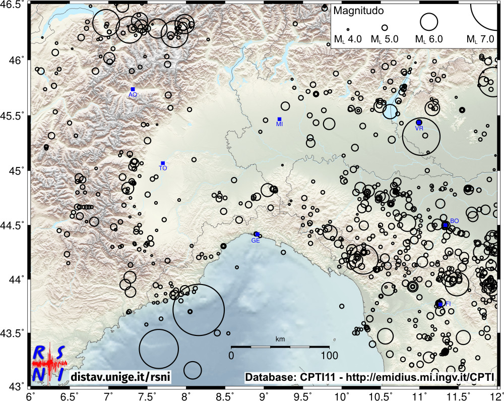
Historical seismicity map of the Northwestern Italy in the period 1000 - 2006
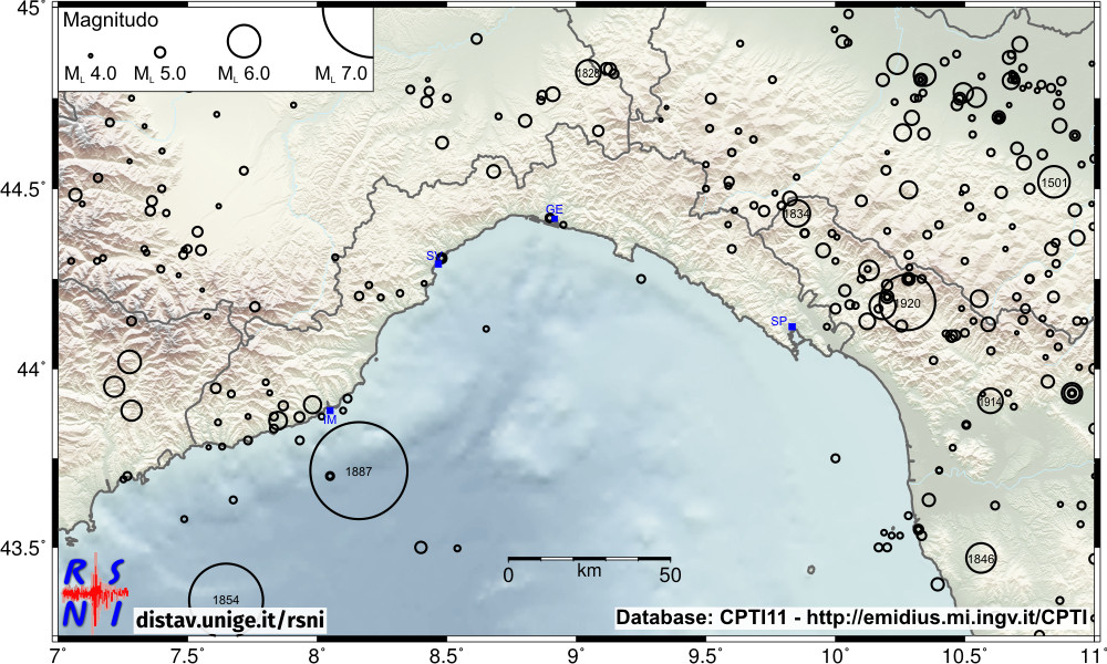
Historical seismicity map of the Liguria and the surrounding areas in the period 1000 - 2006
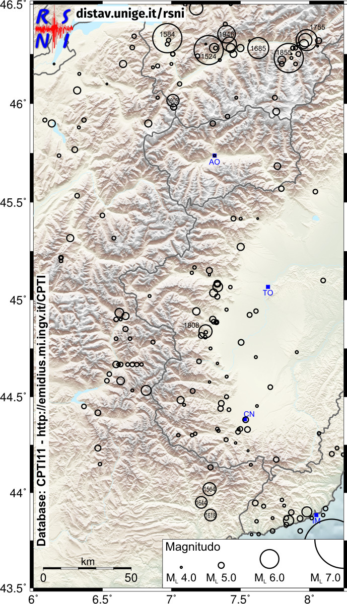
Historical seismicity map of the Western Alps in the period 1000 - 2006
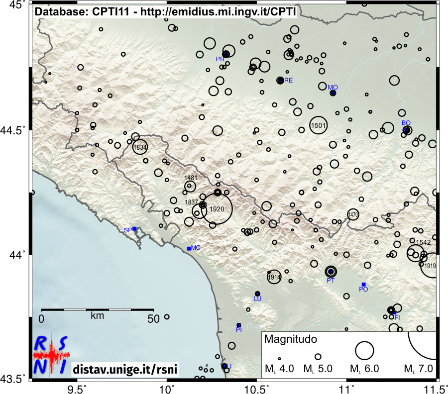
Historical seismicity map of the Northern Apennines in the period 1000 - 2006
Historical seismic data of all maps in this page are taken from the CPTI11 seismic catalog:
A. Rovida, R. Camassi, P. Gasperini e M. Stucchi (a cura di), 2011. CPTI11, la versione 2011 del Catalogo Parametrico dei Terremoti Italiani. Milano, Bologna http://emidius.mi.ingv.it/CPTI