Doldrums Transform System (Equatorial Atlantic)
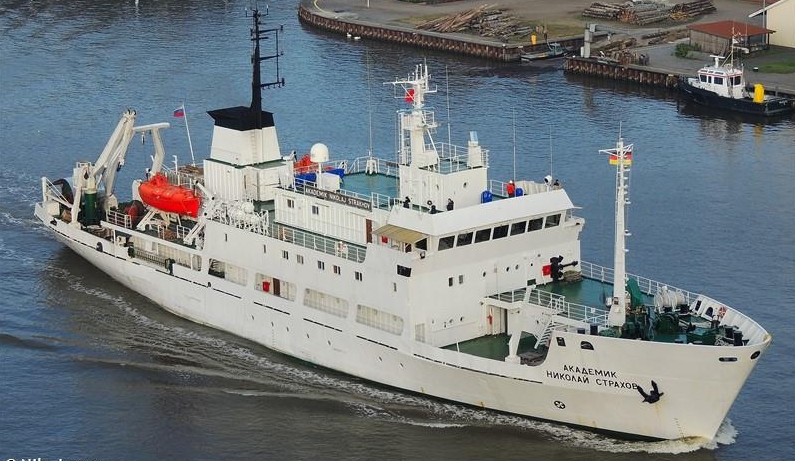
R/V Akademik Nikolaj Strakhov
Scientific rationale and cruise objectives
Our knowledge of the geodynamic evolution of Mid Oceanic Ridges (MOR) relies on the idea that the different sectors of an ocean ridge are connected by discontinuities oriented parallel to the direction of seafloor spreading. These are tectonically active features corresponding to an oceanic transform boundary. In a classical idea, an oceanic transform consists of a single narrow (a few km) strike-slip zone offsetting two mid-ocean ridge segments (Wilson, 1965). However, some oceanic transform domains can be locally characterized by a broad (>100 km) and complex multifault zone of deformation similar to that of some continental strike-slip systems. These domains have exceptionally long age offset (up to 50 Ma), and are regarded as “megatransforms” or megatransform system (MTS) (Ligi et al. 2002). Examples of these MTS are those displacing the Equatorial portion of the Mid-Atlantic Ridge (MAR) such as Romanche and San Paul, or Andrew Bain in the South West Indian Ridge. These long transform zones display particularly complex morphologies, reflecting their evolution through time. In particular, the relative motion along MTS involves the deformation of extraordinarily thick and cold lithosphere. Following this rationale, Ligi et al. (2002) proposed that the extreme thickness of the lithosphere determines the unusual width and complex geometry of MTS. They found that long age-offset (> 30 Ma) faults produce two major symmetrical faults joining the two ridge segments, with a lens-shaped, complex and wide deformed area in between. The composite plate boundaries in these locations fundamentally affect the main processes building the oceanic lithosphere, such as fluid circulation, mantle exhumation, mantle melting and magmatism (see also Sclater et al., 2005).
An archetypical example of megatransform is the Romanche fracture zone (FZ). Here the bathymetry shows that the entire transform domain is deeper than MOR average bathymetry and the lens-shaped deformed region is clearly bounded by two major fault systems, likely active at alternate periods (Ligi et al 2002). The eastern ridge transform intersection (RTI) clearly shows the effects of the lateral cooling due to the thick and cold lithosphere facing the warmer ridge segment tip: the style of spreading changes from normal to oblique and magmatism is reduced, or even absent, when approaching the transform. As a consequence, the accretionary process changes from a symmetric rift valley at the centre of the segment to oblique asymmetric smooth-seafloor-like structures (Cannat et al., 2006) associated to a discontinuous gabbroic layer next to the RTI. Detailed geological data on the variability of volcanism in the region agrees with this idea showing a general decrease in the degree of partial melting approaching the RTI (Ligi et al., 2005). Modelling of the subridge thermal structure suggests that the reason for the constipated magma production is basically due to a decrease in the along-axis thermal gradient (Bonatti et al, 1996a, 2001). Such a strong change in thermal conditions may result in a dramatic reduction of the melting region, possibly reflected in the style of seafloor morphologies. For this reason, the MAR equatorial portion has been interpreted as a major “thermal minimum”, partly due to the “cold edge” effect related to the large offset transforms segmenting the ridge system (Schilling et al 1995; Bonatti, 1996; Bonatti et al., 1996b).
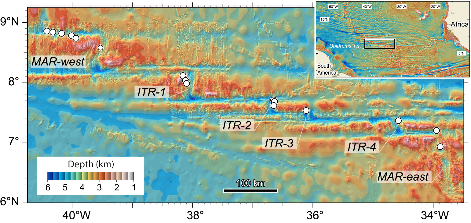
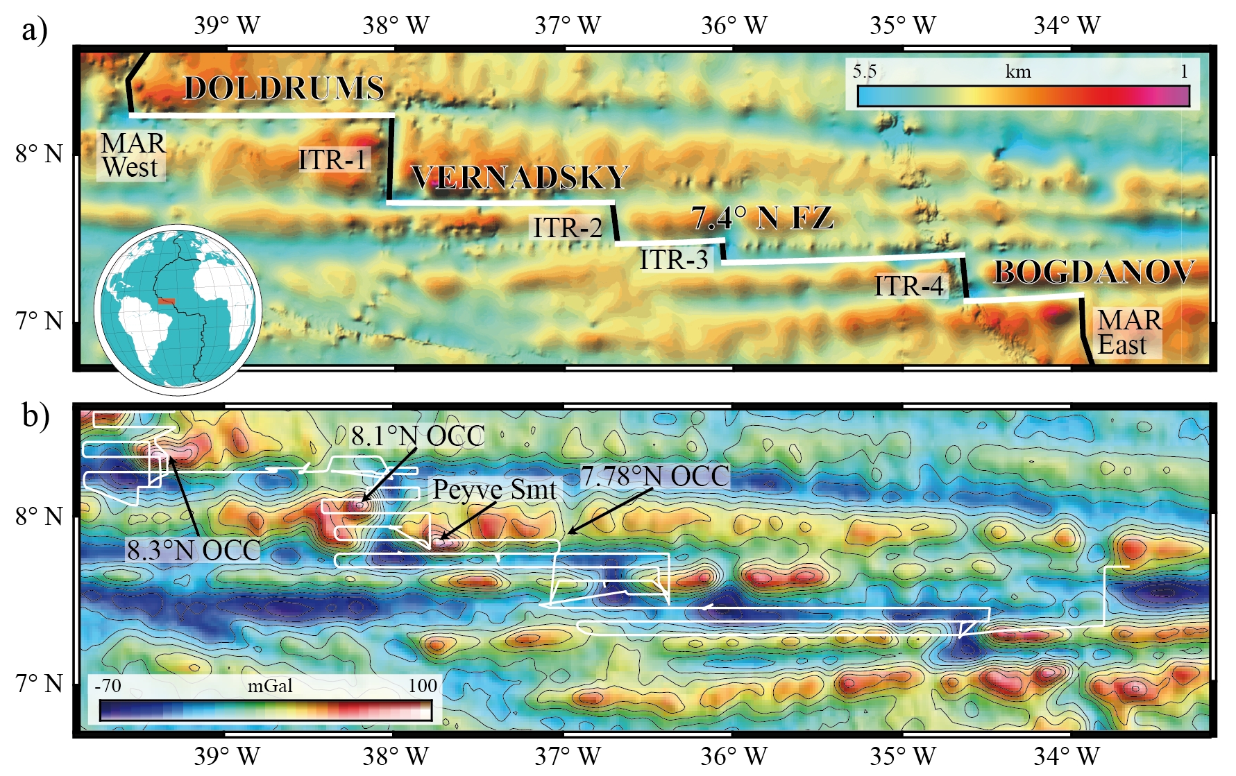
North of the Romanche, the St. Paul system consists of four transform faults separated by three ITRs, offsetting the MAR by ~580 km and displaying a total age contrast of 40 Ma (Hekinian et al., 2000). The occurrence of these ITR is counterintuitive, due to the high lithospheric thickness expected in the central portion of a megatransform. Hence, either active mantle upwelling or changes in plate motions towards a transtensive regime can be driving forces for the opening of the ITR domains (Bonatti et al 1978; Maia et al 2016). North of St Paul, the Doldrums MTS offsets the MAR axis for about 630 km. Although this system is arguably the most complex, including 4 ITRs and 5 transform faults, detailed bathymetric and sample analyses are confined to the westernmost sector (Fig. 1). Yet, there are few data so far on the basalts and basement rocks from this region, making the origin of this long-offset transform domains poorly constrained.
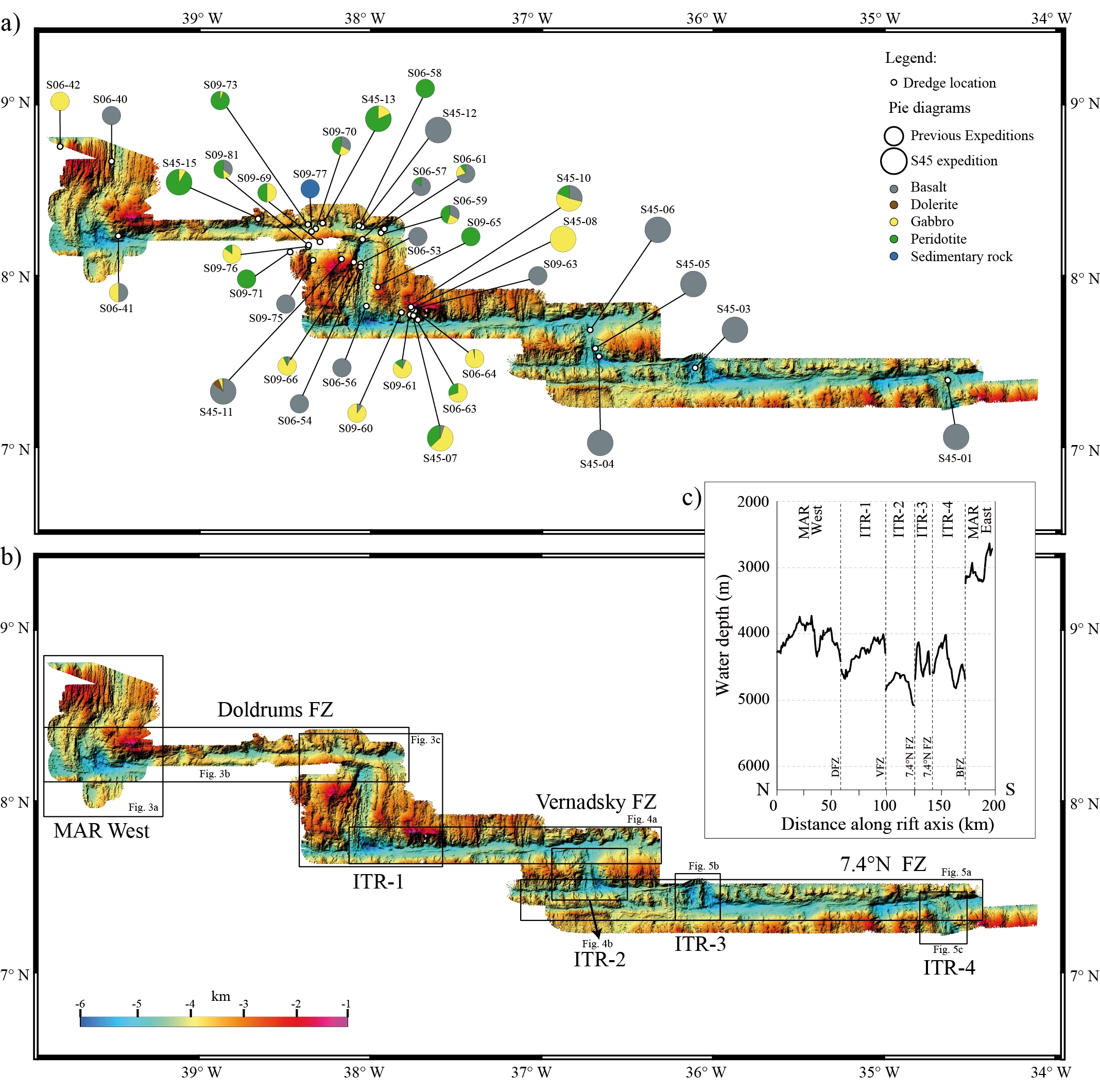
Here we report new geophysical and lithological data on a recent survey conducted from cruise S45 of the R/V Akademik Nikolaj Strakhov (November 2019). Multibeam acquisitions were carried out along the entire megatransform domain, covering the four ITRs for an area of approximately 29000 km2. Along with a preliminary characterization of >1300 kg of rocks from 12 dredges, the new data are here used to reinterpret the evolution of this poorly known MTS.
S45 Survey
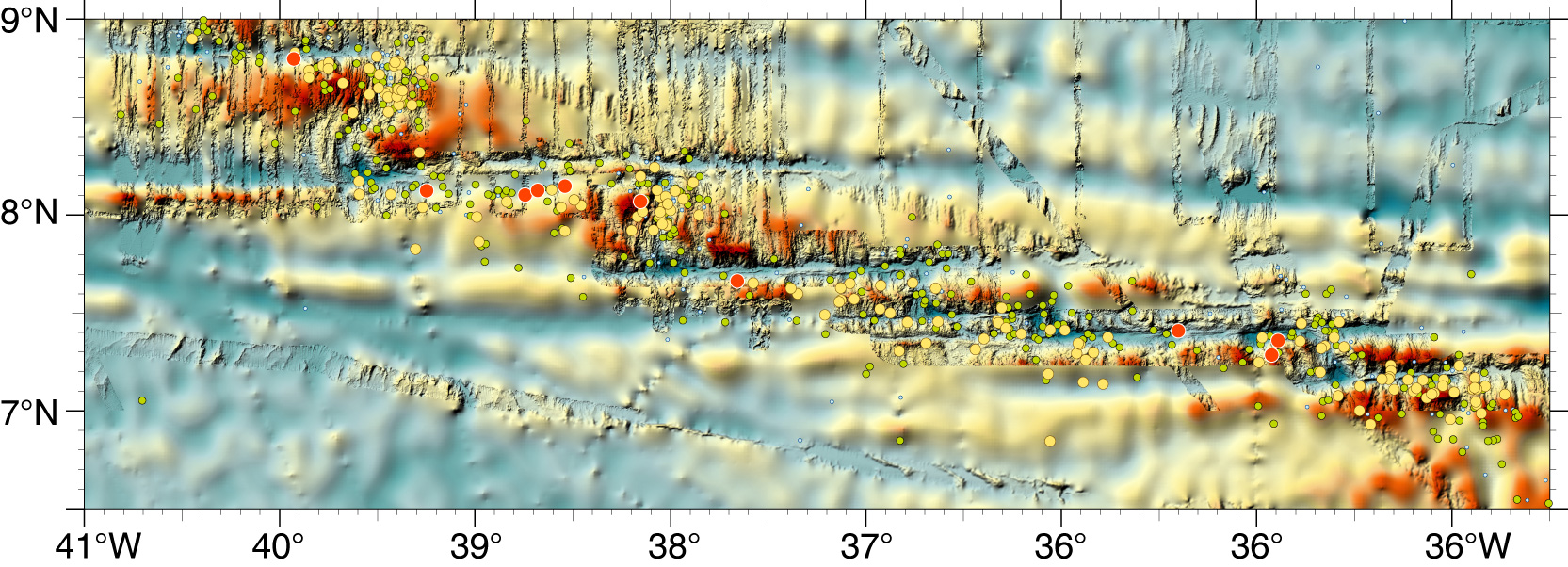
Dodrums Seismicity
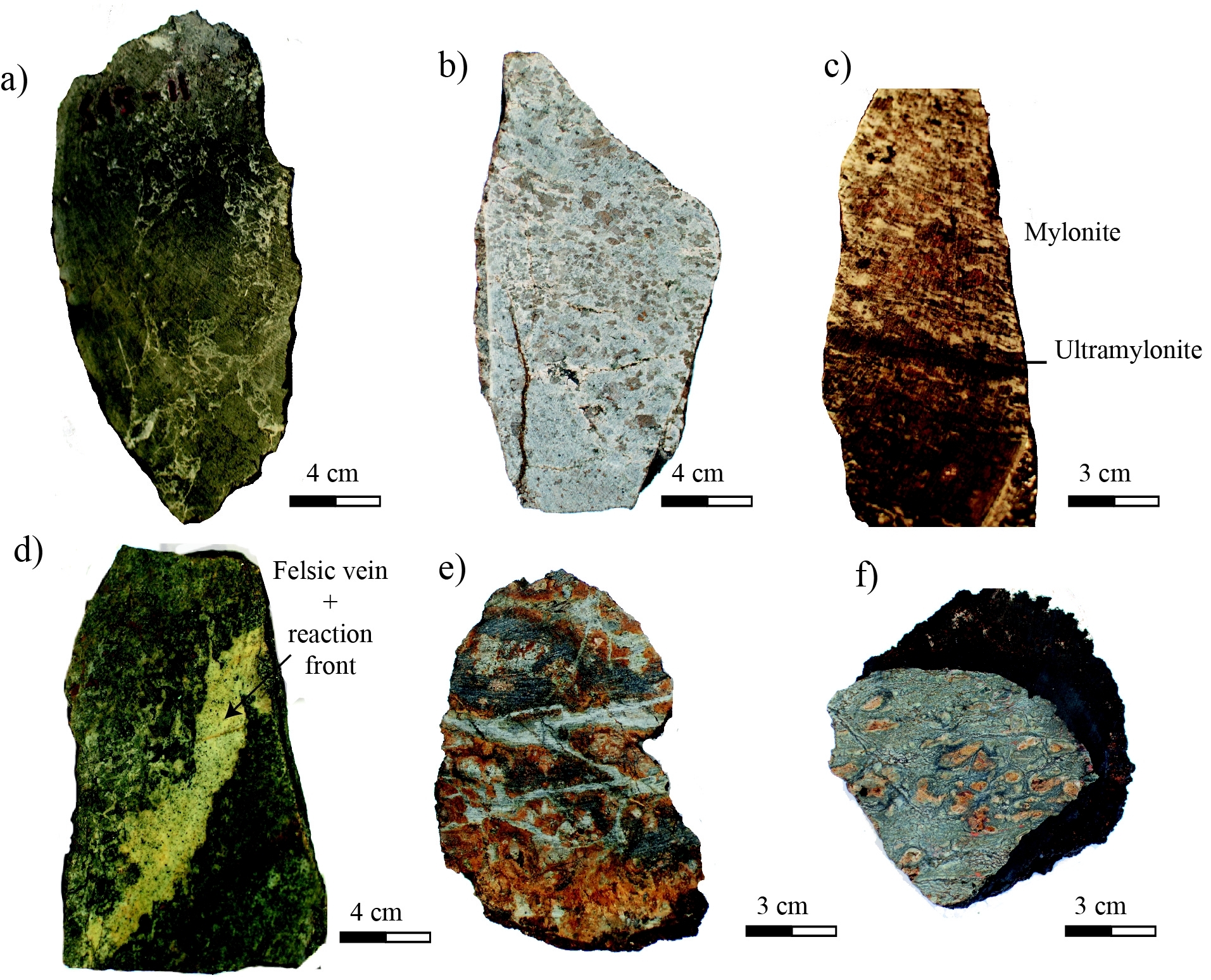
Rock Sampling
Basalts, gabbros and peridotites
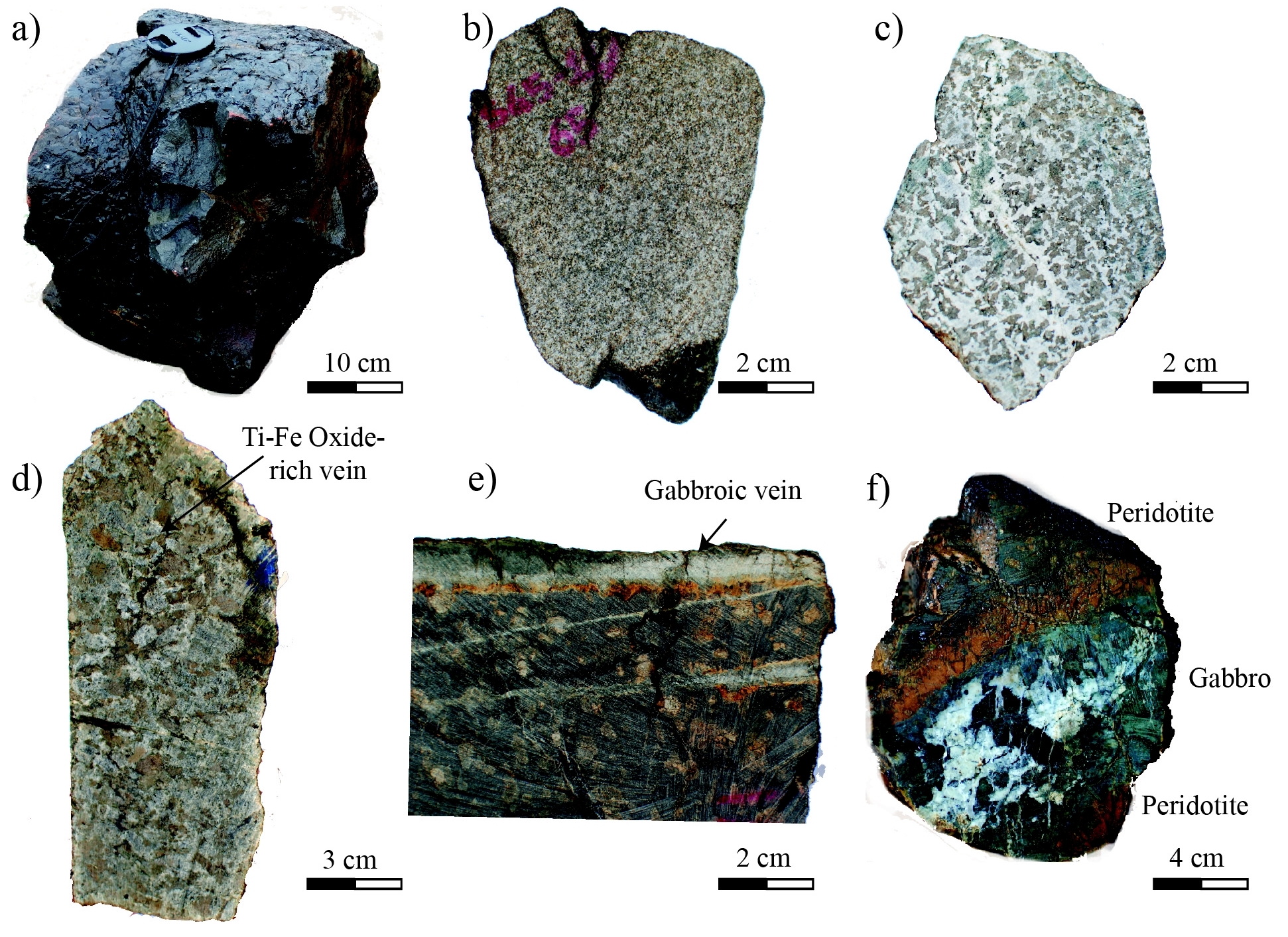
Tectonized magmatic rocks
