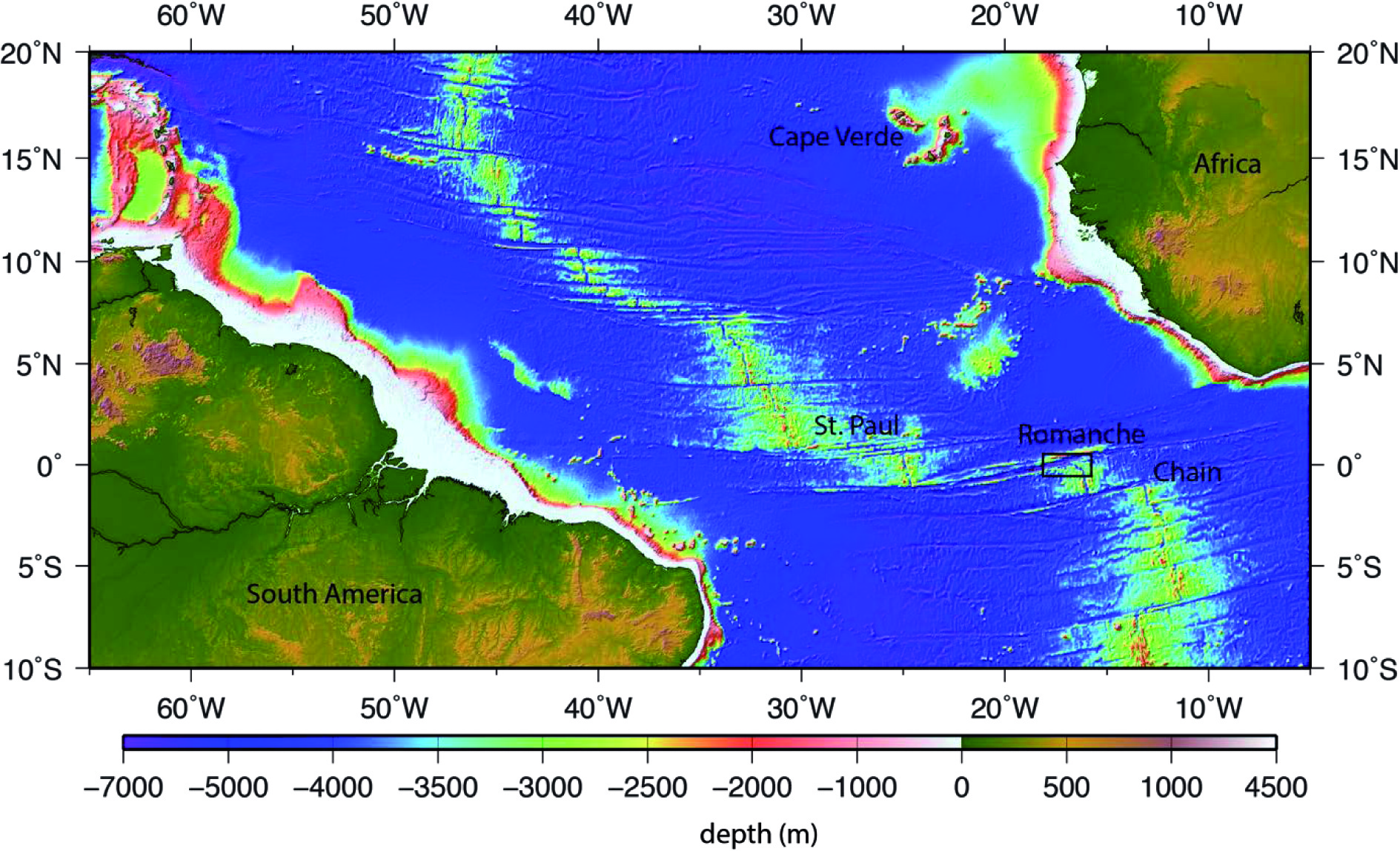
Romanche Eastern RTI (Equatorial Atlantic)
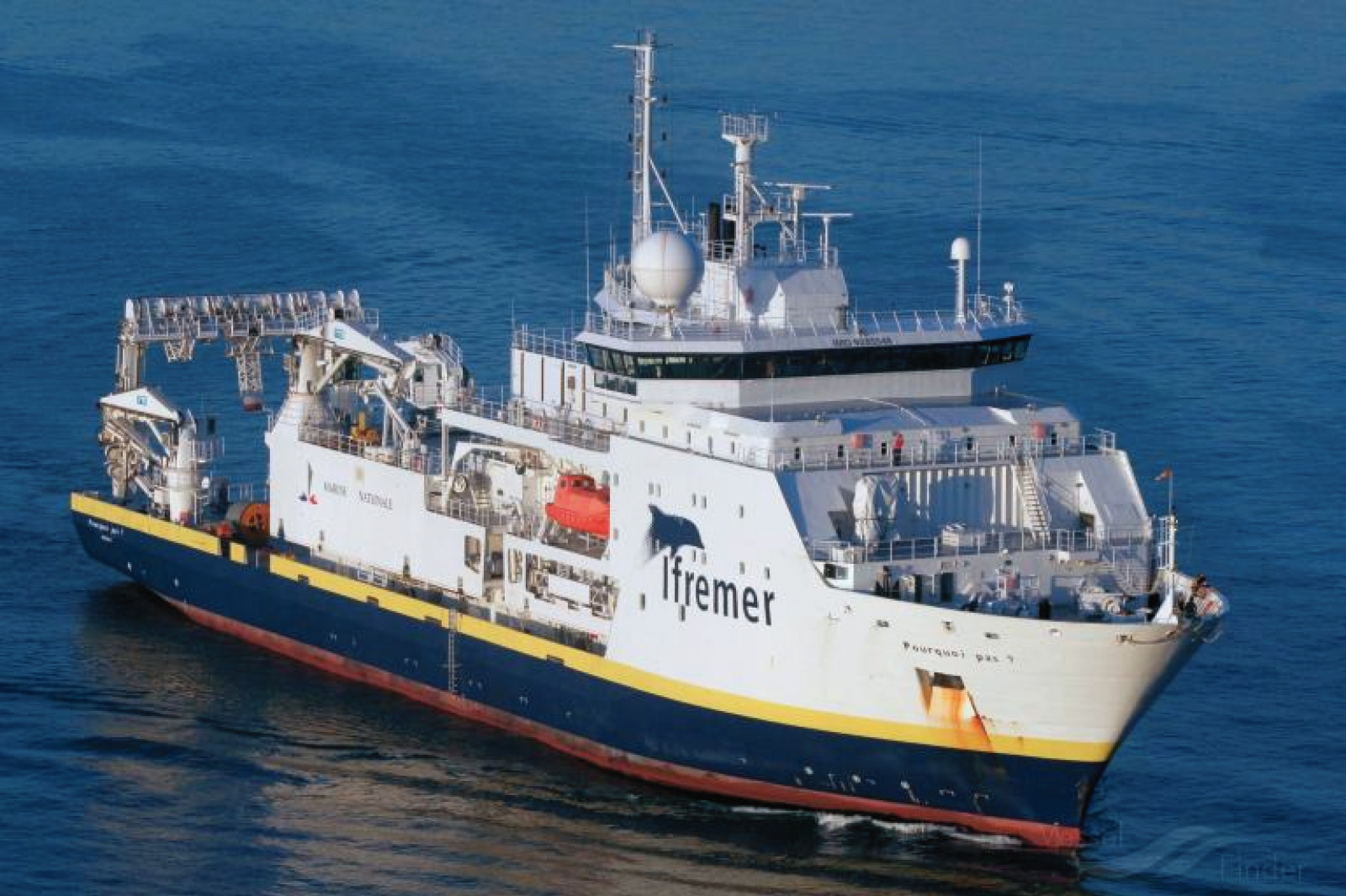
R/V Pourqoui Pas?
Scientific rationale and cruise objectives
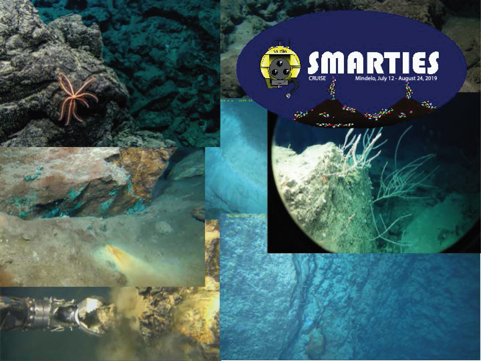
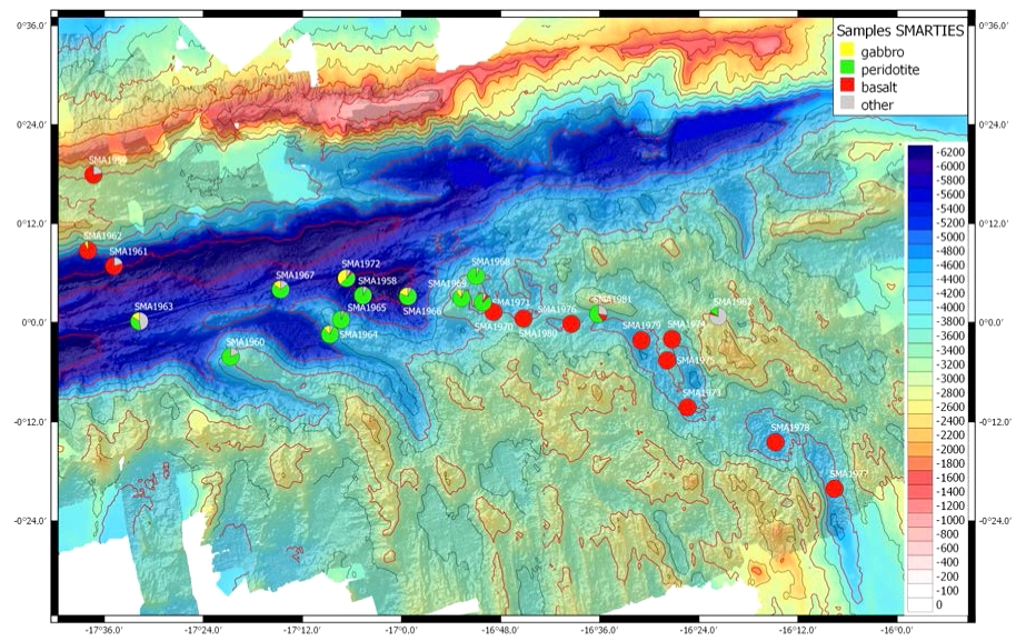
The objective of SMARTIES (Smooth regions at the Mid-Atlantic Ridge Transform-Intersections under Extreme thermal gradient) was to explore the axis of the Mid-Atlantic ridge (MAR) at the intersection with the Romanche transform fault (Figure 1), the longest in the Atlantic (950 km and ~50 Ma of axial and age offsets), and specifically the southeast ridge-transform intersection (RTI). Large-offset transforms, or mega-transforms, induce extreme cooling at the edge of axial ridge segments due to the associated enhanced age contrast and peculiar tectonics. The Equatorial Atlantic hosts several mega transforms, where the interactions between low mantle potential temperatures and large lithospheric age contrast with melt production are poorly understood. The nature of the asthenospheric mantle at this location as well as the cold edge effect induced by the Romanche due to the lithospheric age contrast, result in a portion of the ridge axis where the partial melting rates are exceptionally low (Bonatti et al., 2001). The study area therefore corresponds a strong temperature gradient which results in a passage from a magmatic area to an area where the mantle is exposed at the ocean floor, in the vicinity of the transform. These mantle outcrop areas, very different from the OCCs commonly observed at the MAR axis, are extremely rare and so far, observed only at ultra-slow ridges (e.g. , Indian Southwest ridge, SWIR), at much lower spreading rates.
The cruise is part of a larger international project to study the long offset complex multi-fault transforms of the Equatorial Atlantic. This project follows the COLMEIA cruise (PI M. Maia, CNRS UBO, France, Co-PI S. Sichel, UFF, Brazil, 2013) which obtained bathymetric and geophysical data, as well as rock samples on the St. Paul's multi-transform system.
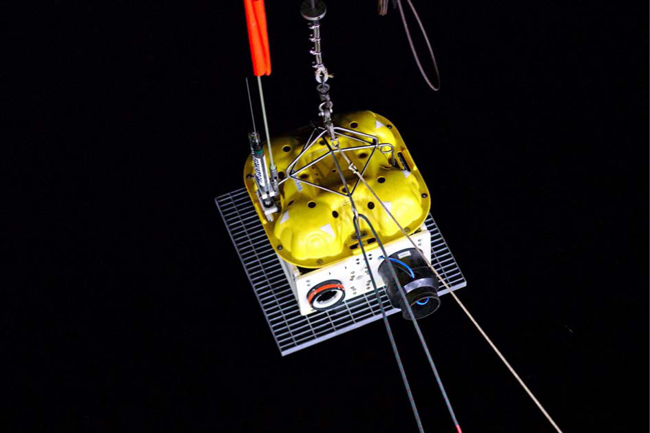
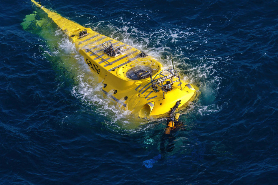
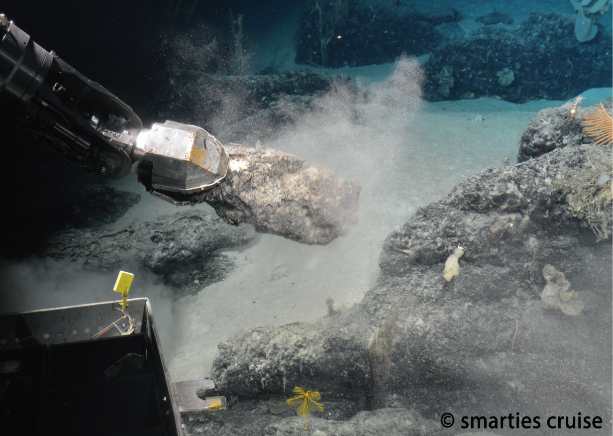
SMARTIES targeted the longest transform oceanic fault in the Atlantic, the Romanche, studied in the 1990s by the team of E. Bonatti from Bologna-WHOI. The cruise strategy (Figure 2) was mainly based on surface mapping with the ship’s echosounder to improve the quality of the available bathymetry data, as well as gravity and magnetics, on performing 25 Nautile dives in several locations along the eastern part of the transform fault valley and walls, the ridge-transform intersection and the ridge axis, and the deployment of 19 OBSs (broadband and short period) for the length of the cruise (five weeks on the target area) in a cooperation with the ILAB project (S. Singh, IPGP). During the cruise we improved the mapping of the region in order to recognize the boundaries of the SSF domain and its persistence through time. We explored in detail the change in deformation patterns on selected targets already identified from available bathymetric data. The detailed study consisted on the acquisition of a surface bathymetry with the largest possible resolution (about 30 m using a very low ship velocity -5 knots – and high overlap) over the main targets and dives with the Nautile to acquire samples, high-resolution images (bathymetry and video/photographs) of the structures as well as near bottom magnetic profiles. The images allow a detailed mapping of the fault and of the deformation patterns of different parts of the RTI, where we observed different, or contrasting, tetonic styles. The sampling strategy targeted the study of rock compositions and rheological properties, with particular attention to the serpentinization process. The integrated study of rock characteristics and of geophysical surveys allows tackling the interactions between magmatism and tectonics. Direct observations and sampling also help to understand the nature of the peculiar alkaline, water-rich, magmatism observed in the region. One of the objectives of the cruise was to improve our understanding of the thermal regime at complex transform domains. As part of the cruise, we were interested on potential hydrothermal activity associated to the large mantle serpentinite exposures and its impact on the chemical and heat transfers from the seafloor to the hydrosphere in a poorly-known region. During the dives, a particular attention was given to finding signals of hydrothermal activity. Traces of such activity were observed on dive #24 and the area was fully explored during dive #25. The OBS experiment was a major asset for the project. The purpose of the deployment was to record seismicity and micro-seismicity in the study area. The expected results of this deployment are diverse, for example, the location of the most active zones and therefore of the ridge axis, in particular in the portion close to the transform fault or the geometry and functioning of the active faults at depth andthe depth of water penetration into the lithosphere. Our study area presents a strong gradient in the temperature of the mantle and the lithosphere and the depth distribution of the seismicity can give us information on the depth of the isotherms of 500-600° C (brittle area) and therefore the maximum depth of serpentinization (Grevemeyer et al., 2013). 18 OBSs were safely retrieved.
OBS Deployments
Nautile Dives
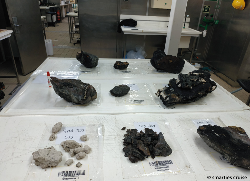
Rock Sampling
Cruise Report
![]() SMARTIES_cruise-report-brief-version.pdf
SMARTIES_cruise-report-brief-version.pdf