The last decades have been characterized by important progress in digital cartographic representation techniques (Geographic Information Systems - GIS), in the availability of high quality georeferenced data (thanks to modern Remote Sensing techniques) and in spatial modeling methodologies.
The ability to integrate information relating to the spatial distribution of marine, terrestrial and freshwater biodiversity with anthropic processes allows us to obtain an overall vision that is difficult to obtain otherwise. The creation of thematic maps of habitats and the calculation of indices based on biodiversity are fundamental tools for the conservation and management of ecosystems protected by European directives and national laws.
Within the theme, DISTAV researchers carry out multiple research activities, including:
1. Modeling of food webs and ecosystems and assessment of ecosystem health (G. Bavestrello, F. Betti, M. Bo, M. Montefalcone, C. Paoli, S. Salvidio, P. Vassallo)
2. Spatial distribution of species, habitats and/or genetic diversity and analysis of the effect of natural and/or anthropic factors (G. Bavestrello, F. Betti, M. Bo, G. Casazza, S. Di Piazza, L. Minuto, M. Montefalcone, C. Paoli, P. Povero, P. Vassallo)
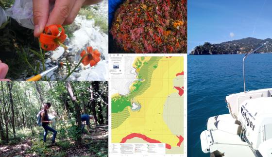
3. Territorial thematic cartography to support spatial planning and land management (G. Casazza, M. Mariotti, L. Minuto, M. Montefalcone)
4. Evaluation of the change over time of species and habitats using diachronic cartography (G. Casazza, L. Minuto, M. Mariotti, M. Montefalcone)
5. Evaluation of the biodiversity of extreme habitats as a "biobank" for the purpose of environmental redevelopment (S. Di Piazza, E. Roccotiello, M. Zotti)
6. Risk assessment for local biodiversity in relation to anthropic pressures (M. Mariotti, E. Roccotiello, M. Zotti)
7. Spatial decision support systems (C. Paoli, P. Povero, P. Vassallo)