Geo-hydrological risk comes from the existence of vulnerable elements that can be affected, or damaged, by geomorphological phenomena such as landslides, floods, erosion, and sinkholes.
Earth’s landforms are continuously modified by both natural and anthropic geomorphologic agent. Moreover, especially in recent decades, human activities have greatly impacted the physical environment, often exacerbating the consequences of surficial geomorphic processes. For these reasons, there is as an urgent need to carry out accurate analyses of geo-hydrological risk scenarios in space and time aimed at developing suitable, effective, and sustainable risk prevention and mitigation strategies.
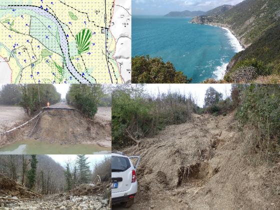
In the framework of this topic, DISTAV researchers carry out multiple research activities:
- Landslide monitoring; landslide susceptibility and hazard analysis, assessment and zoning; analysis of landslide risk mitigation measures (P. Brandolini, A. Cevasco, F. Faccini, G. Pepe, I. Rellini);
- Evaluation of the geomorphological characteristics and dynamics of rivers; flood hazard and risk analysis and assessment (P.i Brandolini, A. Cevasco, F. Faccini, A. Mandarino, G. Pepe, I. Rellini);
- Analysis and modelling of beach and of sea rocky cliff erosion; analysis and modelling of coastal engineering works; evaluation of the effectiveness of beach nourishments; assessment of vulnerability to marine coastal floods; extreme marine events analysis and modelling (P. Brandolini, A. Cevasco, F. Faccini, M. Ferrari, G. Pepe);
- Soil erosion monitoring and modelling (I. Rellini).